Impact Assessments
Measuring the socioeconomic benefits that Earth observations provide when people use them to make decisions
Overview
The VALUABLES Consortium is measuring the socioeconomic benefits that Earth observations provide when people use them to make specific decisions to manage water resources, health and air quality, climate change, wildfires, and more. To do this, we are conducting a series of impact assessments. These are rigorous, quantitative studies that investigate how people use improved information to make these decisions and quantify how these decisions improve socioeconomically-meaningful outcomes such as lives saved or resources conserved.
Popular in fields like international development, impact assessments quantify the changes that can be attributed to a particular intervention like a project, program, or policy. We are conducting impact assessments for specific satellite data applications using an approach called the value of information (VOI). The VOI method compares outcomes in two different states of the world: a state in which action is taken based on currently-available information and a different state in which action is taken using improved information. The difference in socioeconomically-meaningful outcomes between the two states represents the value of the information.
VALUABLES Impact Assessments
Our impact assessments include work that quantifies the value of using satellite data to:
- Protect endangered species: The satellite data product WhaleWatch incorporates remote sensing to identify more precisely where blue whales are located in time and space, enabling their conservation at a lower cost. Read the full working paper.
- Inform post-wildfire response: The US Forest Service Burned Area Emergency Response (BAER) team uses Landsat imagery to design cost-effective mitigation and recovery plans for the human and natural systems impacted by wildfire. Read the journal article.
- Enforce air quality standards: Satellite data could be used to improve monitoring of county-level compliance with federal air quality standards and prioritize air pollution control activities that protect human health. Read the full working paper.
- Regulate air emissions from oil and gas development: Monitoring air quality using satellites can improve our understanding of the relationship between emissions from oil and gas development and infant health outcomes.
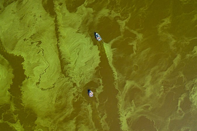
- Detect harmful algal blooms: Remote sensing can detect harmful algal blooms in recreational lakes and help managers take necessary steps to protect human health. Read the journal article, the Resources article, and the full working paper describing this work.
- Improve predictability of corn and soybean prices: Satellite-based applications can reduce weather-related uncertainty that contributes to risk for agricultural commodity consumers and producers. Read the journal article.
- Improve drought and river flow forecasts: Three-month soil moisture forecasts based on data from the GRACE satellites could be used to improve policy responses to drought and flooding.
VALUABLES Community Impact Assessments
The consortium is also supporting research from the VALUABLES community to quantify the benefits of using satellite data in decisions that improve socioeconomic outcomes for people and the environment.
This includes impact assessments on health, ecosystems, and water quality applications funded under VALUABLES' 2020 Grants for Assessing the Benefits of Satellites (GABS). Learn more about the GABS teams and their projects. These projects were led by researchers from Moravian College, Salisbury University, and the University of Wyoming.
Additional VALUABLES-supported impact assessments led by researchers from Arizona State University and the Georgia Institute of Technology measure the value of using satellite data to:
- Halt disease transmission: Using satellite data to produce more accurate maps and population estimates can support vaccination campaigns and limit the spread of disease. Read the full working paper.
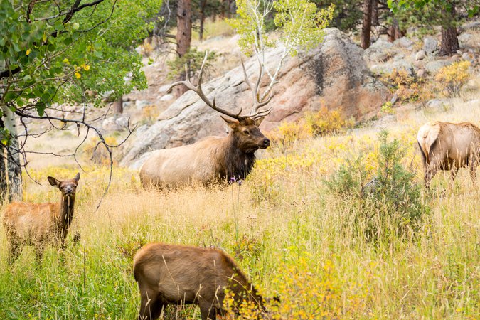
- Support elk migration: Developing modeling approaches based on satellite data can provide information on how to design cost-effective migratory corridors. Read the full working paper.
Receive updates about new impact assessments by subscribing to our email newsletter and following us on Twitter @RFFvaluables.
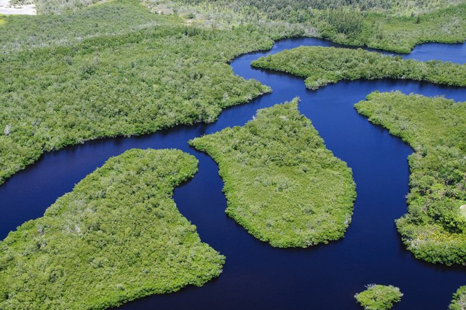
Ecosystems and Endangered Species
Working Paper — Oct 19, 2022
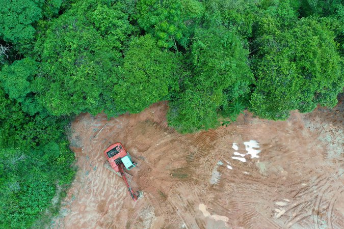
Estimating the Value of Near-Real-Time Satellite Information for Monitoring Deforestation in the Brazilian Amazon
Estimating the Value of Near-Real-Time Satellite Information for Monitoring Deforestation in the Brazilian Amazon
Working Paper — Oct 19, 2022
The Value of Remotely-Sensed Data in Terrestrial Habitat Corridor Design for Large Migratory Species
The Value of Remotely-Sensed Data in Terrestrial Habitat Corridor Design for Large Migratory Species
Working Paper — Apr 26, 2021
Earth Observations Can Enable Cost-Effective Conservation of Eastern North Pacific Blue Whales: A Value of Information Analysis
Earth Observations Can Enable Cost-Effective Conservation of Eastern North Pacific Blue Whales: A Value of Information Analysis
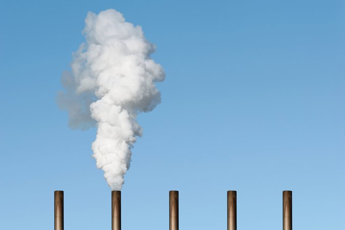
Health and Air Quality
Working Paper — Oct 19, 2022
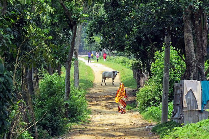
Early Warning Systems, Mobile Technology, and Cholera Aversion: Evidence from Rural Bangladesh
Early Warning Systems, Mobile Technology, and Cholera Aversion: Evidence from Rural Bangladesh
Working Paper — Oct 19, 2022
Examining the Value of Satellite Data in Halting Transmission of Polio in Nigeria: A Socioeconomic Analysis
Authors calculate the increase in the likelihood of halting transmission of polio associated with the use of the satellite-based information compared to traditional data sources and consider the benefits associated with savings to the healthcare system.
Working Paper — Sep 12, 2018
Using Satellite Data to Fill the Gaps in the US Air Pollution Monitoring Network
This paper uses new satellite data to assess fine particulate matter concentrations and finds that 24.4 million more Americans than previously thought live in counties that do not meet the annual health standard set under the Clean Air Act.
Water Resources
Working Paper — Oct 19, 2022
Valuing Satellite Data for Harmful Algal Bloom Early Warning Systems
In this working paper, authors develop an information valuation framework for harmful algal blooms (HABs) and apply it to a case study of outdoor recreation in California.
Journal Article — Jun 18, 2020
Quantifying the Human Health Benefits of Using Satellite Information to Detect Cyanobacterial Harmful Algal Blooms and Manage Recreational Advisories in US Lakes
Quantifying the Human Health Benefits of Using Satellite Information to Detect Cyanobacterial Harmful Algal Blooms and Manage Recreational Advisories in US Lakes
Wildfires
Journal Article — Oct 22, 2020
Monetising the Savings of Remotely Sensed Data and Information in Burn Area Emergency Response (BAER) Wildfire Assessment
Monetising the Savings of Remotely Sensed Data and Information in Burn Area Emergency Response (BAER) Wildfire Assessment
Working Paper — Jul 11, 2019
The Cost-Effectiveness of Satellite Earth Observations to Inform a Post-Wildfire Response
The Cost-Effectiveness of Satellite Earth Observations to Inform a Post-Wildfire Response
Opportunities, Methods, and Techniques
The following studies from RFF experts and collaborators reflect on opportunities to increase the societal value of scientific information or demonstrate methods and analytical techniques to advance this work, providing a foundation for future VOI impact assessments.
Report — Feb 9, 2021
The Societal Value of NOAA's Digital Coast
The Societal Value of NOAA's Digital Coast
Report — Feb 18, 2021
The Societal Value of the HYSPLIT Air Dispersion Model
The Societal Value of the HYSPLIT Air Dispersion Model
Journal Article — Mar 3, 2020
Ten rules to increase the societal value of earth observations
Ten rules to increase the societal value of earth observations
Journal Article — Nov 13, 2019
Market-Based Methods for Monetizing Uncertainty Reduction
Market-Based Methods for Monetizing Uncertainty Reduction
Working Paper — Jun 27, 2019
Market-Based Methods for Monetizing Uncertainty Reduction: A Case Study
Market-Based Methods for Monetizing Uncertainty Reduction: A Case Study
Journal Article — May 20, 2019
Ice Sheet Contributions to Future Sea Level Rise from Structured Expert Judgment
Ice Sheet Contributions to Future Sea Level Rise from Structured Expert Judgment

Journal Article — Mar 29, 2019
Monetizing the Value of Measurements of Equilibrium Climate Sensitivity Using the Social Cost of Carbon
Monetizing the Value of Measurements of Equilibrium Climate Sensitivity Using the Social Cost of Carbon
Journal Article — Nov 5, 2018
Probabilistic reasoning about measurements of equilibrium climate sensitivity: combining disparate lines of evidence
Probabilistic reasoning about measurements of equilibrium climate sensitivity: combining disparate lines of evidence
Journal Article — Nov 29, 2017
The Value of Remotely Sensed Information: The Case of a GRACE-Enhanced Drought Severity Index
The Value of Remotely Sensed Information: The Case of a GRACE-Enhanced Drought Severity Index
Journal Article — Jun 13, 2013
Value of information for climate observing systems
Value of information for climate observing systems